Showing posts with label maps. Show all posts

Monday, December 08, 2008

amAze - Free GPS navigation for your mobile phone!

amAze - Free GPS navigation for your mobile phone!amAze is a free mobile local search and navigation application. It enables you to view high resolution maps in many places over the world, to have voice guided navigation to any destination (if you`ll also have a GPS), to search in local search directories databases, to view weather forecasts and more. It is a very useful daily tool for everyone. You do not need to own a fancy smart phone to use it, since amAze can run on any Java enabled regular phone. Additional mobile phone platforms will be supported soon.

Free Download: here

Friday, November 07, 2008

Nokia Friend View, an experimental location and micro-blogging service to feel close to your friends

Why?
Because it is nice to feel close to your friends! With Friend View it is fun to check what’s up with your friends, and share where you are with them whenever you feel like it.

How?
After installing the application and logging in, a simple way to start is by checking our Tips and Mini-help. It explains all the features available from web or phone and explains practical details such as shortcuts and graphic indicators to know, for example, if you are sharing your location with others or not, if a location is precise or not, etc.

To log in to Friend View you need to have a Nokia Account. If you already have one, just login with your Nokia Account username and password to Friend View.

To start sharing posts or locations you need to add friends, and they have to accept you as a friend of course, or the other way around. So it is all about good friends and people you love, Friend View only makes it more fun!

Home, office, on the go!
Friend View works in many S60 3rd Edition phones (the complete list of tested phones is listed in the download page). Friend View also has a web browser interface that lets you follow up from home or elsewhere (so far supports only Firefox and Safari but we are working on IE as well).

Free Download: here

via: rodrigostoledo.com

Thursday, October 23, 2008

Mobile Trail Explorer - Explore your trails using the mobile phone and GPS unit

Mobile Trail Explorer - Explore your trails using the mobile phone and GPS unitMobile Trail Explorer is an application where user can view and record tracks using the mobile phone and GPS device. Recorded tracks can be exported in KML or GPX format. KML file can be viewed in Google Earth application. Mobile Trail Explorer is mainly targeted for recording biking, hiking etc. trails.

Software runs on Java platform so it is supported by many mobile phones. It is required that mobile phone supports Bluetooth connections (JSR 82) for GPS and File connection (JSR 75) for exporting trails to kml files.

Free Download: TrailExplorer.jar and TrailExplorer.jad

Wednesday, October 15, 2008

Trapster - Speed Trap Sharing System

Trapster - Speed Trap Sharing SystemTrapster® users share the location of police speed traps by a simply clicking their mobile phones. The system uses the phone's GPS capabilities and the Internet to instantly alert other users as they approach the reported trap.

Free Download: tms.jad and tmu.jad

Monday, October 13, 2008

Mobile Yandex.Maps

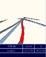
Mobile Yandex.MapsYandex.Maps has launched a mobile application. Now all Yandex.Maps options, like house and street search, traffic jams in Moscow, Kiev and others cities.

Mobile Yandex.Maps is compatible with any phone that supports Java MIDP2.0, and with any device supporting Symbian or Windows Mobile. In other words it is compatible with any phone model issued starting 2004.
The application uploads only relevant segments of the map, which minimizes the volume and the cost of data traffic.
Besides all options of the "desktop" version, when using a GPS device, mobile maps will show user's location and direction.

Free Download: here

Tuesday, September 09, 2008

We-Travel is Java mobile phone navigation system

We-Travel is Java mobile phone navigation systemWe-Travel is a totally free navigation software for java enabled mobile phones, based on map data from Open Street Map.

Free Download: here

Wednesday, April 30, 2008

Sunclock is a J2ME Midlet that displays a map of the Earth

Sunclock is a J2ME Midlet that displays a map of the EarthSunclock is a J2ME Midlet that displays a map of the Earth and indicates the illuminated portion of the globe by drawing sunlit areas dark on light, night areas as light on dark. In addition to providing local time for the default timezone, it also displays up to four additional cities on the map with the local times also. The map updated every minute to follow the movement of the earth.

Using the Setup menu you can choose the cities according to your interest. You can give the DST rules for the chosen city. If you have internet access on your handset you should search the city using the "Search" menu and the remote service will find the proper DST rule settings for you. Otherwise you should use the provided online DST rule search service on the top right corner of this page. You have to specify the correct timezone values relative from GMT (for example +5.5hours will appear as 530) and the integer WGS-84 coordinates multiplied by ten (N14.7432 will be lat: 147) of the cities to display them on the map. Thus most of the current phones do not supports the timezone settings, the localtime will be calculated based on the Main City setup and the internal phone clock will be interpreted as a timezone corrected local time value according to the Main City timezone selection.

Free Download:
Sunclock128.jar - midlet for 128 pixel wide screens
Sunclock176.jar - midlet for 176 pixel wide screens
Sunclock220.jar - midlet for 220 pixel wide screens
Sunclock240.jar - midlet for 240 pixel wide screens
Sunclock320.jar - midlet for 320 pixel wide screens

Tech Tags: , , , , freeware

Thursday, April 10, 2008

MicroSky is a planetarium for mobile phones

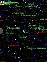
MicroSky is a planetarium for mobile phonesMicroSky is a planetarium for mobile/cell devices with Java-support and a connection to the Internet (preferably GPRS or UMTS). It is a very small J2ME-Midlet client/server application which retrieves its starcharts from the skyserver. It can display 2.500.000 stars, 8.000 deep sky objects, the constellations, the planets, local horizon, 1000 current comets, and minor planets. MicroSky provides lots of functions and settings for customizing the MicroSky-Charts to your individual needs.

Microsky v3 extends v2 with even more functions such as a more polished style, Bluetooth-GPS support and a offline mode that reduces the GPRS costs and enables MicroSky for outdoor regions without GPRS reception.

To use MicroSky on your mobile phone you will need a User and Password to login: Register here for free

Free Download:
MicroSky v2 for mobile devices which support at least J2ME MIDP 1.0
MicroSky v3 without Bluetooth-Api with internal bluetooth and offline feature for mobile devices which support J2ME MIDP 2.0 and no Bluetooth-Api (JSR 82)
MicroSky v3 with Bluetooth-Api with additional bluetooth and offline feature for mobile devices which support J2ME MIDP 2.0 and Bluetooth-Api (JSR 82)

Tech Tags: , , , , freeware

Saturday, January 12, 2008

Yahoo! Go

Yahoo! GoYahoo! Go is an all-in-one offering that lets you enjoy the best of the Internet on your phone—for free.* Send an email, upload photos, download a map, search for answers, check stock quotes, or get breaking news—all that and much more is available through Yahoo! Go.

Free Download: just type this URL into your phone's browser: get.go.yahoo.com

*Your carrier’s standard charges may apply.

via: rodrigostoledo.com

Saturday, September 15, 2007

Nokia Mobile Search

Search, Find, Connect - the Nokia Mobile Search software for Nokia mobile phones is a simple, convenient, and fast way to find and connect to local services, websites, images, and content in your mobile - all from the palm of your hand. And best of all, Nokia Mobile Search software is free.

Download free here

Friday, September 14, 2007

Wayfinder Earth beta for Series 60

With the power of Tele Atlas, Wayfinder puts the whole world at your fingertips. Get a view of the entire planet as a 3D globe on your mobile phone. Then simply choose a location and zoom in to city street level. Check out the best bars, restaurants, museums or hotels and get there without a hitch.

Download free from getjar.com

Thursday, April 19, 2007

Take the power of Google Maps with you on your mobile phone.

  • Real-time traffic — See where the congestion is, and estimate delays in over 30 major US metropolitan areas.
  • Detailed directions — Whether you plan to walk or drive, your route is displayed on the map itself, together with step-by-step directions.
  • Integrated search results — Local business locations and contact information appear all in one place, integrated on your map.
  • Easily movable maps — Interactive maps let you zoom in or out, and move in all directions so you can orient yourself visually.
  • Satellite imagery — Get a bird's eye view of your desired location. (It's like you're there, we swear.)


To try just, point your phone web browser to www.google.com/gmm